Gennadius Library acquires 18th century manuscript map of Corfu
A map of Corfu drawn in 1705 by the Italian engineer Alberghetti and entitled “Pianta e Prospetto Occidentale di Corfù” was acquired in auction (Vergos, November 2019).
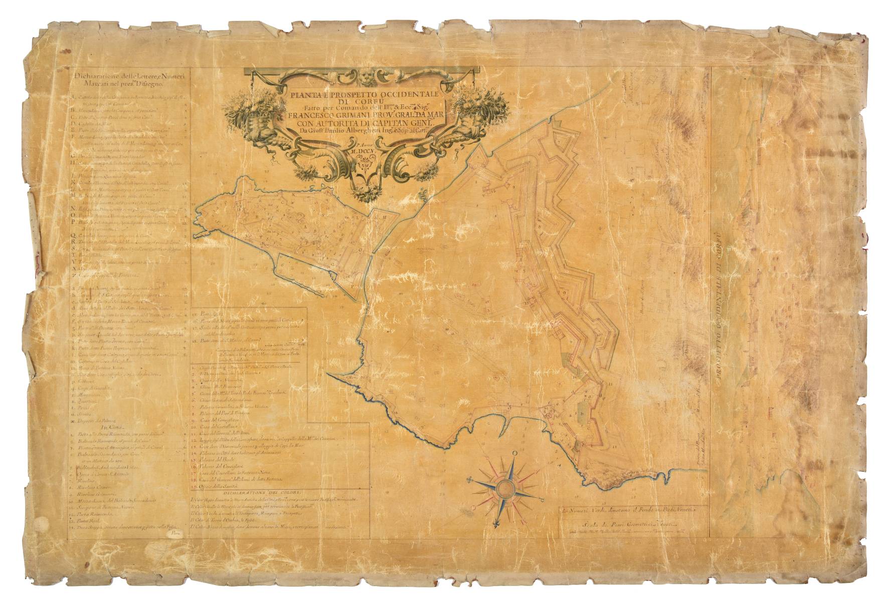
The hand drawn map is a detailed representation of the fortifications, official buildings, palaces, public servants’ residences, churches, wells and cisterns of the Venetian city of Corfu. The map also indicates the fortifications that need to be completed and includes new fortification proposals. A two-dimensional drawing of the profile of the city of Corfu from the West complements the map. A long legend on the left explains the salient features on the map.

As indicated in the beautiful cartouche, the map was drawn by Giust’Emilio Alberghetti at the order of Francesco Grimani, Provveditore General da Mar (general governor of the naval forces of the Republic of Venice) based in Corfu. Alberghetti was a notable engineer at the service of the Venetian Republic who at the time held the titled of the Sopraidente alle Artiglerie (Supervisor of the Artillery).
A similar map is held by the communal library of Treviso. Alberghetti had already collaborated with another member of the Grimani family, Francesco’s brother Giovanni, for the creation of a magnificent map of Dalmatia (1699).
Research on the Alberghetti map, an important acquisition that enriches the Gennadius collections on Venetian history, was conducted by Stavros Grimanis.